Quad chair lift with people during winter ski season descending through a pine forest covered by cloudsQuad chair lift with people during winter ski season descending through a pine forest covered by clouds

Geilo piste map

Detailed piste map of Geilo highlighting top ski runs and lifts
31th December, 2024
5 min read time

Nestled in the heart of Norway and situated halfway between Oslo and Bergen, Geilo offers a range of pistes that cater to all skill levels. As you prepare for a ski vacation to this premier destination, ensure that you first download the latest Geilo piste map. This indispensable guide provides a detailed overview of the resort’s expansive skiing and snowboarding areas, highlighting the various ski lifts, trail difficulties, and the distinct zones within the resort.

Geilo ski resort piste map

Download it here, or pick up a copy at ticket offices and information points throughout the resort.
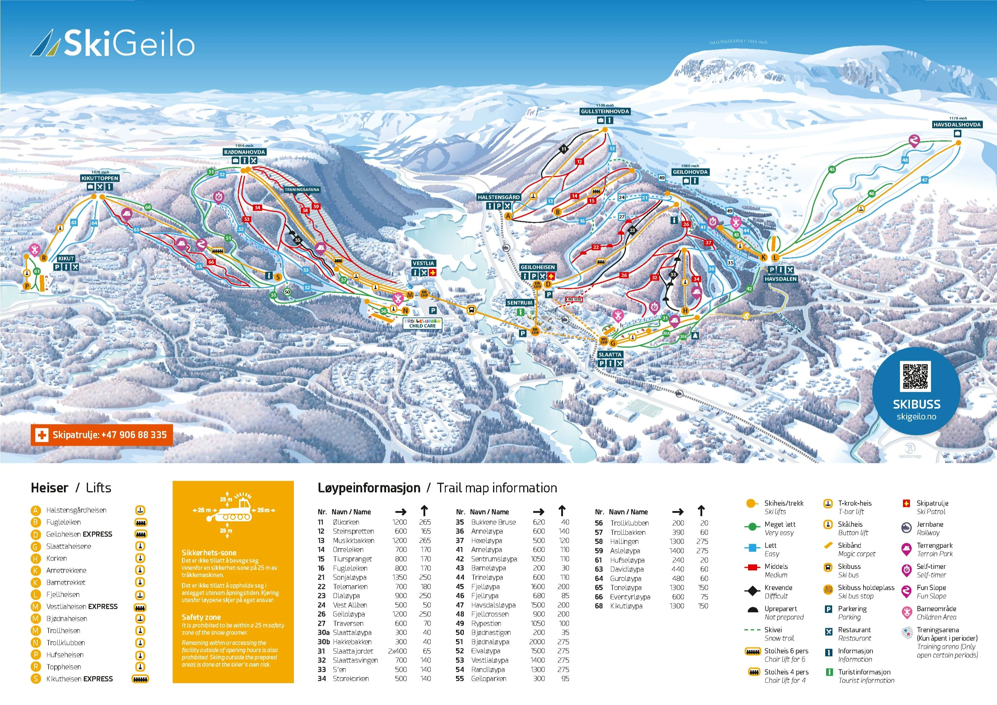
Geilo ski resort piste map

Geilo piste map downloads

Click on the links below to download the latest Geilo piste map

  1. Geilo piste map pdf
  2. Geilo piste map jpg

Geilo ski resort in brief

  • Base elevation: 800 m
  • Summit elevation: 1,178 m
  • Vertical drop: 378 m
  • Number of pistes: 46
  • Type of pistes: 30% green, 33% blue, 30% red, 7% black
  • Downhill total length: 34.2 km
  • Snow-making: 26 km
  • Number of ski lifts: 22
  • Cross-country trails: 220 km
  • Snow parks: 3

Related guides