A snowy town in Telluride, Colorado, with a clocktower in the foreground and mountains in the backgroundA snowy town in Telluride, Colorado, with a clocktower in the foreground and mountains in the background

Telluride piste map

Detailed piste map of Telluride highlighting top ski runs and lifts
4th December, 2024
2 min read time

Telluride, nestled in the majestic San Juan Mountains of Colorado, is celebrated for its dramatic scenery and world-class skiing. This resort offers a perfect blend of advanced terrain and beginner-friendly slopes, making it a top choice for skiers of all levels. Download the latest Telluride piste map to access essential information about the resort's varied ski terrain, iconic ski runs, and modern lift system, ensuring you have the best possible experience during your skiing holiday.
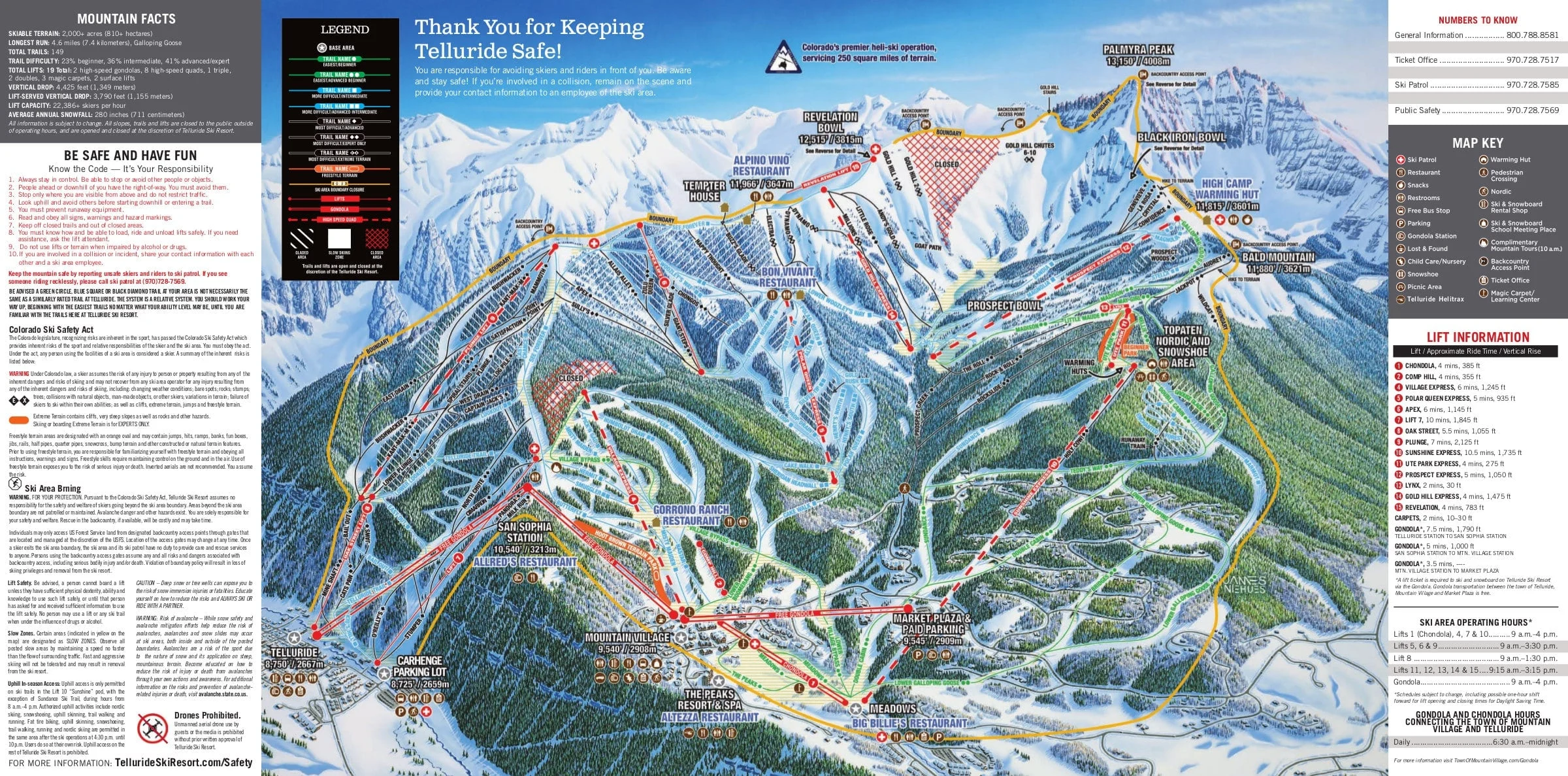
Telluride ski resort piste map

Download the latest Telluride piste map

Telluride ski resort piste map

Telluride piste map downloads

  1. Telluride piste map pdf
  2. Telluride piste map jpg

Telluride ski resort in brief

  • Skiable terrain: +810 ha (+ 2,000 acres)
  • Base elevation: 2,659 m (8,724 feet)
  • Top elevation: 3,815 m (12,516 feet)
  • Vertical drop: 1,349 m (4,426 feet)
  • Ski pistes: 148
  • Type of ski pistes:  23% beginner, 36% intermediate, 41% advanced
  • Longest piste: 7.4 km (4.6 miles)
  • Ski lifts: 17
  • Terrain parks: 3
  • Halfpipe: 1

View all our resorts in the USA

Aspen - Beaver Creek - Deer Valley - Breckenridge - Keystone - Park City -Jackson Hole - Telluride - Vail

Related guides