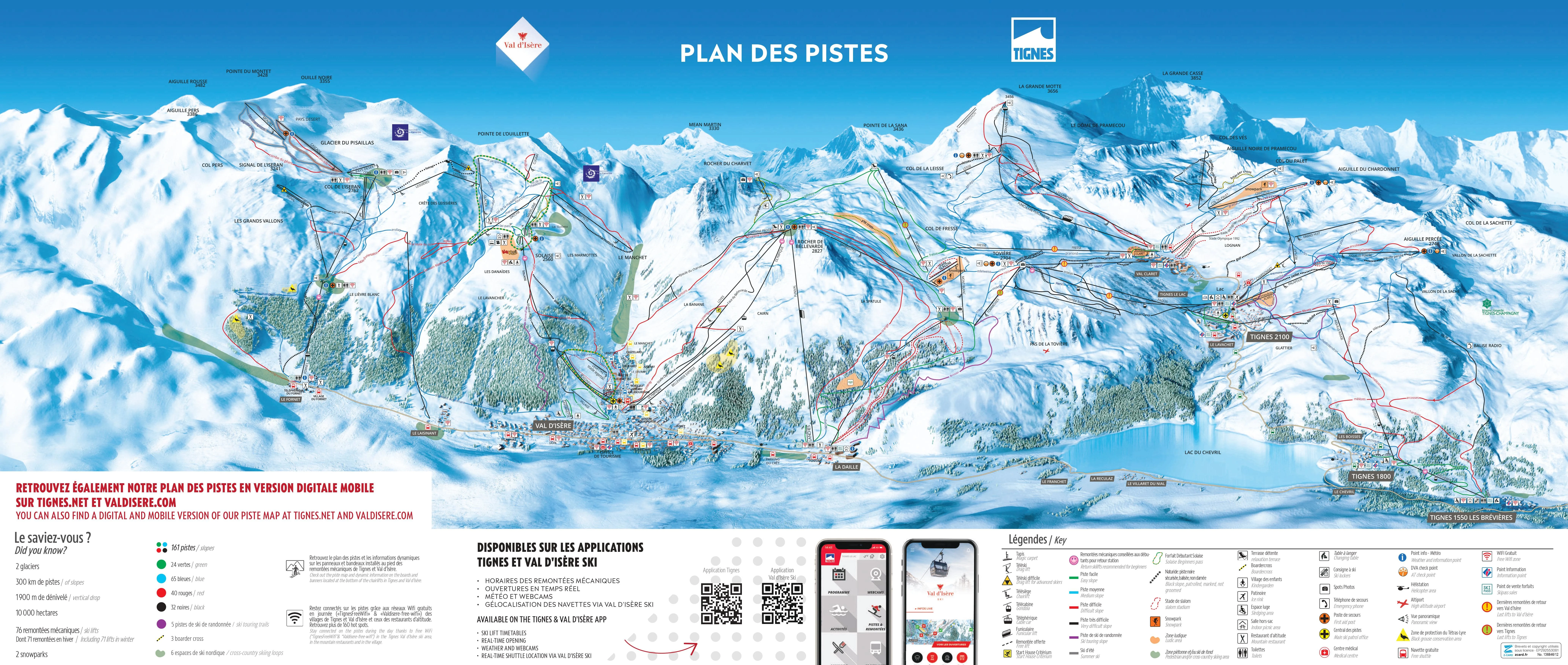

Nestled in the stunning Vanoise National Park, Val d'Isère is one of the crown jewels of the French Alps, renowned for its extensive and challenging ski terrain that forms part of the Espace Killy ski area alongside Tignes. As you prepare to explore this world-class ski destination, be sure to download the latest Val d'Isère piste map. This essential guide offers detailed insights into the resort's diverse pistes, showcasing the various levels of difficulty, lift locations, and seamless connections to Tignes. The map also highlights key amenities such as slope-side restaurants, emergency services, and leisure facilities.
Download the piste map here, or pick up a copy at ticket offices and information points throughout the resort.

Click on the links below to download the latest Val d'Isère, Espace Killy piste map

At the heart of the Val d'Isère ski area, the Pisaillas Glacier offers a spectacular high-altitude skiing experience. Positioned at an altitude of over 3,200 meters, the glacier provides approximately 10 km of skiable terrain, making it an ideal spot for summer skiing, depending on snow conditions. Click on the links below to download the latest Val d'Isère-Pisaillas Glacier piste map.
Val Thorens - La Plagne - Chamonix - Tignes - Avoriaz - Val d'Isère - Méribel - Les Arcs - Les Menuires - Courchevel - Flaine - La Clusaz - Serre Chevalier - Samoëns - La Rosière - Montgenèvre - Val Cenis - Megève - St Martin de Belleville - Isola 2000 - Risoul - Valmorel - Les Gets - Morzine - Les Deux Alpes - Alpe d'Huez - Vaujany - Sainte Foy Tarentaise - Saint Gervais les bains - Châtel - Les Houches - Les Sybelles - Les Carroz - Les Contamines-Montjoie - Les Orres - Les Saisies